|
Homeowner’s Guide to Waterfront Living Cobbosseecontee
Lake, Maple Ridge Island 119 Maple Ridge Drive, Monmouth, Maine 04259-7334 Hosted By: mapleridgelive.com Description Lot #95 on Monmouth, Maine Tax Map 24 Main Menu Page Menu Description
Lot #95 on Monmouth, Maine Tax Map 24 Page Menu Main Menu Postal
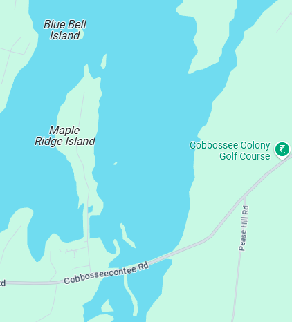
and EMS Address and Lat-Lon Two Aireal Photo of the North end of Maple Ridge
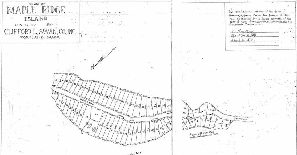
Island The 1948 St. Moritz Club Maple Ridge Island Plan The
1965 “Cliford Swan Co.” Maple Ridge Island Plan See the Page Lot 95 Location
for more information Lot #95 General
Description Lot
#95 on Monmouth Maine Tax Map #24 is the last lot on Maple Ridge Island at
the end of Maple Ridge Drive on the West side of the road. Lot #95 is a delta
(Triangular) shaped property facing North on the shore of Cobbosseecontee
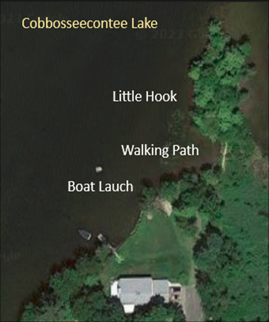
Lake. Lot #95 has a boat Launch and boat dock
as seen below. Lot #95 is unique in that
it terminates with a singular hook of land reaching out into Cobbosseecontee
Lake as a peninsula known to the current owners of Lot #95 as Petit
Crochet “Little Hook”. “Little
Hook” is a waterfront projection of land that extends off the North end of
Maple Ridge Island from Lot #95 out into Cobbossee Lake. That “little hook” of land
was officially declared as part of the deed to Lot #95 by The 2019 Maine Superior Cort 2019
Decree. You can see the Walking
Path to “Little Hook” in the Airial Photo below and the Ground
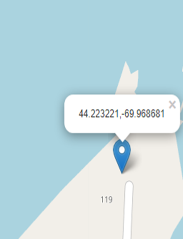
Level Photo taken at the start of the walkway. Postal and EMS Address This is a detailed
description of Lot #95 on Monmouth, Maine Tax Map 24. The US Postal and 911 EMS Systems address of Lot #95 is: 119 Maple Ridge Drive, Monmouth, Maine 04259-7334. Lot #95 is physically
located at Latitude 44.223221, Longitude -69.958681 and is described on the Current Registered Deed and is graphicly displayed on the
Registered
Survey and on the Monmouth, Maine Tax
Map #24 Lot 95 Detail Lat & Lon location of Lot #95 from Google Maps
Lot #95 Survey See About Lot 95 Survey for information related to the
survey See The Survey
for exact dimensions of Lot #95 and positions of the features of Lot #95. Note the survey
error that incorrectly labels The Lot as #96 while The Monmouth Tax Map 24
displays it as Lot #95. Lot #96 is assigned to Blue Bell Island as seen on
the Monmouth, Maine Tax
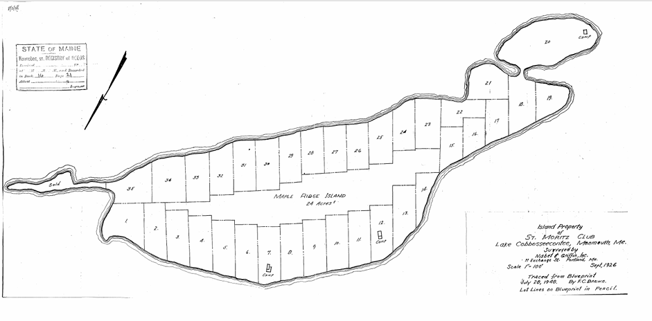
Map #24 Lot 95 Detail. The 1948 St. Moritz Club
Plan The 1948 St. Moritz Club
Plan associated with the development of Maple Ridge Island is a
"Point-of-Interest" for further research. Note from the Title Block
of the y1948 St. Moritz Club Plan that it is based on the "Sept.
1926" Survey of "Nisbet & Griffin Inc. 11 Exchange St,
Portland, Me" and was "Traced from a blueprint” by "C.F.
Brown" who noted " Lot lines on Blueprint in pencil". The 1948
St. Moritz Club Plan is recorded in Book 8, Page 28 of the Kennebec County
and Registry of Deeds and is further referenced in the 1954 Daken
and Chick Deed to Maple Ridge Island as the more current 1955 Clifford Swan
Survey was not yet submitted and recorded. The St Moritz Club Plan identifies
only three camps on Maple Ridge Island Image of The July
20, 1948 Moritz Club Plan “traced from
blueprint” by "C.F. Brown" of the September,
1926 Survey by Nesbit & Griffin Inc., 11 Exchange St Portland, ME noted
that the “Lot Lines on blueprint (were) in pencil”. Download a copy of the original July 20, 1948 Moritz Club Plan Image of The Original Plan
of Maple Ridge Island
Two Aireal Photo of Lot #95 Aireal Photo of Lot#95 showing the
home. The front lawn, Boat Dock, Boat
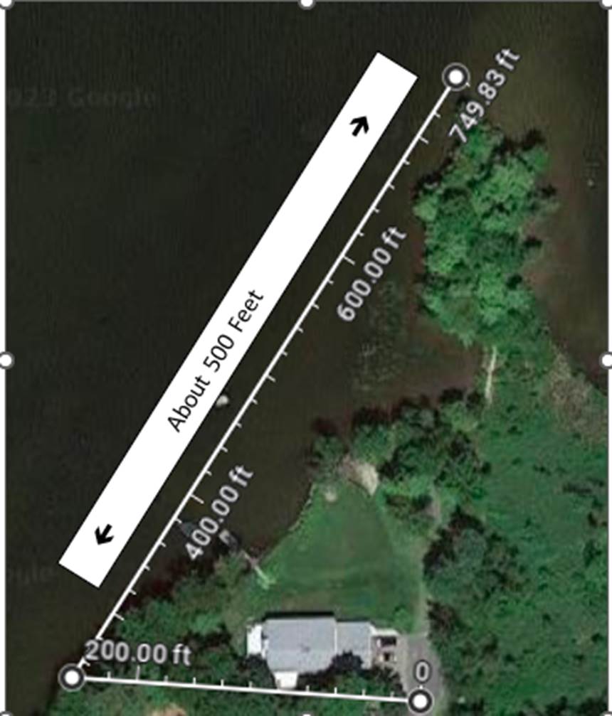
Launch, The Well, and the Walking Path to Little Hook. Note the triangular shape of Lot #95
1. It
is 172 Feet between the two South survey pins. 2. It
is 227 Feet from the Southwest Pin to the Boat Ramp. 3.
It is about 280 Feet from The Launch
to the end of Little Hook. 4.
The measured lines drawn on the photo
are made with “Google Maps Measuring Device” and accumulate their footage
moving west and then North. They
approximate the surveyed lines with the shoreline of the lake as the natural West
boundary of the lot. Page File Information: |