|
Maple Ridge Island History
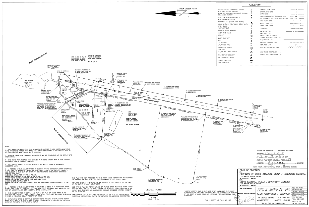
Collaborative 2018 Survey, North Road and Lot #95 Hosted by: MapleRidgeLive.com The
2018 Survey The
2018 Survey defines the North end of Maple Ridge Drive with its centerline
and two sidelines of the deeded fifty-foot road right-of-way from the top of
the hill to the end of the road as it terminates in the wetlands. The Survey
complies with the 1965
Clifford Swan Co. Plan as surveyed by Boudreau and Manne in that same
year, 1965. The
survey documents an important distinction between the defined 50-foot
Right-of- Way and the actual “Traveled Way” the road makes as it is on the
ground; noting that the actual road is not anywhere 50 feet wide and that the
Right-of-Way extends on to the abutting Lots along the entire road. See
the “Traveled Way”, of the actual road, marked off on the Survey as dashed
lines mostly, but not always, well within the 50-foot Right-of-Way. See
Book 2018 Page 139 at the Kennebec County and Registry of Deeds for a copy of
the original 2018 Survey. Survey
Error There
is an error on the Survey which incorrectly labels Lot #95 as Lot #96. The registered Deed and the Monmouth Tax
Map #24 both identify the Lot as #95. See the Image of The
Survey below Select this Link to download a full copy of the Survey Or this one: Link to an image of the Survey
Page File Information: |
|
|
|
|
|
|
|