Owners Guide
119 Maple Ridge Drive, Monmouth,
Maine 04259-7334
The Waterfront
|
|
Select this
symbol to return to the top of this Menu. è Δ
View these
photos of the Front Shore. See Little
Hook for its shoreline.
|
Waterfront at the Picnic
Area with Anchor Stones, Riprap and Berm |
|
|
Main
Shoreline in front of Home with Stone Wall, Berm and Rose Hedge |
|
1. Location:
|
The
waterfront is a complex environmental transition zone from land to lake. |
2. Notes / Overview / Description:
|
The
waterfront conditions vary from day to day, with waves action intensity
caused by wind and boat activity. Seasonal changes in water levels and the
accumulation and breakup of winter and spring ice represent challenges to the
consistency and uniformity of the waterfront transition zone. The character of the
Warter Front is greatly determined by the incline or steepness of the banking
as it declines to the water.
Storms winds, especially “Nor-Easters” cause
significant wave action at the shoreline.
The wave action will interact with the waterfront at different
elevations and with different impact depending on seasonal water levels and
the presents of ice. The Lake’s impact on the land is erosion of the
bank. The land
also impacts the lake with pollution. Solids
which include the erosion mentioned above that wash soil from the banking
into the lake can significantly change the chemistry of the lake altering the
acidity (pH) and the nitrogen levels which stimulate algae blooms. Wind
driven dust, trash and especially storm water runoff are significant sources
of water pollution. The two (2) goals of
waterfront management are to protect the land from erosion and to protect the
lake from pollution. There are several
engineered features of the waterfront of Lot #96 that support those twin goals
to avert erosion and pollution.
To prevent erosion
of the banking, the wave action zone must be prepared based on the Department
of Environmental Protection (DEP) guidelines for erosion control.
See Information for Shorefront Property
Owners, Maine Department of Environmental Protection.
The
“front line” of protection against erosion are “anchor stone” large enough to
withstand the pressure of wave action and powerful ice movements caused by
expansion in very cold weather and the breakup and movement of spring
ice. Behind the large anchor stones
are Riprap (smaller jagged stone fragments).
Above the stone foundation is an earthen berm to dam up storm water
runoff before it can get directly to the lake. The berm is topped with a hedge or other
spreading vegetation that can put down tenacious roots to hold the berm
together.
Where runoff occurs
a diverter system must be installed. See the
Boat Launch Diverter (Use the “Back Button” ç to
return to this page)
Most of the
Waterfront of Lot #96 has many of the features described above to limit
erosion and pollution.
|
3. Photos / Graphics:
|
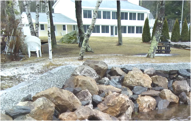
Waterfront with Anchor Stones,
Riprap and Berm; looking back from the walkway to Little Hook toward the Boat
Launch in early Winter |
|
|
|
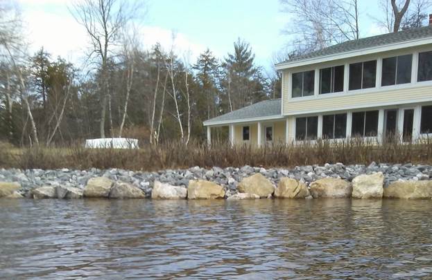
Waterfront,
early Spring at “Full Pond” with Anchor Stones, Riprap and Rose Hedge atop
Berm ready to sprout. |
|
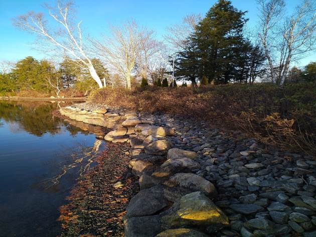
Winter view of Waterfront at “Low Pond” with Anchor Rocks,
Riprap and Rose Hedge atop Berm from Docks to Boat Launch |
4. Operation:
5. Maintenance:
a. Trim back spreading Rose Hedge as
needed.
b. Run the installed Irrigators and set
up sprinklers during dry periods.
6. Reference / Links:
Maine Department of Environmental Protection
University of Minnesota Extension
7. Other:
C:\Users\administrator.MAPLERIDGELIVE.001\OneDrive\1StWebsite\119MRD\Base_System_Page.htm